GPS + Prism Poles: The Perfect Combo for Faster, Smarter Measurements
When it comes to modern surveying and construction, efficiency and precision are non-negotiable. That’s why GPS + Prism Poles have become an essential tool for professionals who demand speed without sacrificing accuracy. Whether you're conducting land surveys, construction layout, or topographic mapping, GPS + Prism Poles provide a seamless way to capture data with unmatched reliability. But do they really work as well as they claim? Let’s dive in.

Do GPS + Prism Poles Really Work?
Absolutely! The combination of GPS technology and prism poles creates a powerful surveying solution that enhances productivity while reducing human error. Here’s why this duo is a game-changer:
1. Enhanced Speed & Efficiency
Traditional surveying methods often require multiple setups and manual measurements, which can be time-consuming. With GPS + Prism Poles, surveyors can quickly collect data in real-time, drastically cutting down fieldwork hours.
2. Superior Accuracy & Reliability
High-quality prism poles work in tandem with RTK (Real-Time Kinematic) GPS systems, delivering centimeter-level precision. This ensures that measurements are consistent, reducing the risk of costly rework.
3. Versatility Across Terrains
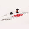
Whether you're working on rugged landscapes, urban construction sites, or open fields, GPS + Prism Poles adapt effortlessly. Many models feature adjustable heights and robust materials (like carbon fiber or aluminum) to withstand tough conditions.
4. Seamless Data Integration
Modern prism poles are often compatible with surveying software, allowing for instant data transfer to CAD or GIS systems. This eliminates manual entry errors and speeds up project workflows.
Key Applications of GPS + Prism Poles
The GPS + Prism Poles combo isn’t just for surveyors—it’s a must-have across multiple industries:
Construction Layout – Precisely mark foundations, roads, and structures.
Land Surveying – Quickly map boundaries and topographical features.
Infrastructure Projects – Monitor alignments for roads, bridges, and pipelines.
Agriculture – Optimize land use with precise field measurements.
Mining & Quarrying – Ensure accurate volumetric calculations.

Not all GPS + Prism Poles are created equal. Here’s what to look for before purchasing:
Material – Carbon fiber (lightweight & durable) or aluminum (strong & cost-effective).
Height Adjustability – Telescopic poles with locking mechanisms for stability.
Compatibility – Ensure it works with your GPS receiver (e.g., Leica, Trimble, Topcon).
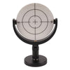
Prism Type – 360° prisms offer better flexibility for angle measurements.
Weight & Portability – A lightweight yet sturdy design improves fieldwork efficiency.
For the best performance, always choose high-quality GPS + Prism Poles from trusted manufacturers like SMTOER, who specialize in precision surveying equipment.
Conclusion
There’s no denying that GPS + Prism Poles are revolutionizing the way professionals collect data—delivering speed, accuracy, and versatility in a single package. Whether you're a land surveyor, civil engineer, or construction manager, this powerful combo will streamline your workflow and enhance project outcomes.
Ready to upgrade your surveying tools? Contact SMTOER today for top-tier GPS + Prism Poles designed for professionals who refuse to compromise on quality. Get yours now and experience the difference!
