New Choice for Precise Measurement: Extendable GPS Pole Helps Land and Engineering Measurement
Introduction to GPS Poles in Surveying
In the world of land surveying and engineering measurement, accuracy and efficiency are paramount. One essential tool that enhances precision in surveying is the GPS pole, a crucial accessory for GNSS (Global Navigation Satellite System) receivers. Among the various options available, the extendable GPS pole stands out as a versatile and practical solution for professionals who require adaptability in different terrains and measurement scenarios.
Whether used for topographic surveys, construction layout, or GIS data collection, an extendable GPS pole ensures stability, height adjustment, and improved signal reception—making it a must-have for surveyors and engineers.

How an Extendable GPS Pole Helps Land and Engineering Measurement
1. Adjustable Height for Optimal Signal Reception
A key advantage of an extendable GPS pole is its adjustable height, which allows surveyors to customize the pole’s length based on the environment. Taller poles help minimize signal interference from obstacles like trees or buildings, while shorter settings provide better stability in windy conditions.
2. Lightweight and Portable Design
Unlike fixed-length poles, an extendable GPS pole is designed for easy transport and quick setup. Many models are made from carbon fiber or aluminum, offering a perfect balance between durability and weight, making them ideal for fieldwork.
3. Enhanced Stability for Accurate Measurements
A wobbling pole can lead to measurement errors, but high-quality extendable GPS poles feature non-slip grips, reinforced joints, and quick-lock mechanisms to ensure rigidity during operation. This stability is crucial for high-precision surveying tasks.
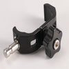
4. Compatibility with Multiple GNSS Receivers
A well-designed GPS pole should be universally compatible with leading GNSS brands like Trimble, Leica, and Topcon. This flexibility allows surveyors to switch between different receivers without needing multiple poles.
5. Durable Construction for Harsh Environments
Surveying often takes place in challenging conditions—rain, dust, or rough terrain. The best extendable GPS poles are weather-resistant, corrosion-proof, and impact-resistant, ensuring long-term reliability.

Key Applications of GPS Poles in Surveying
The extendable GPS pole is widely used across various industries, including:
Land Surveying – For boundary marking, topographic mapping, and cadastral surveys.
Construction & Engineering – Site layout, as-built verification, and machine control.
Agriculture – Precision farming and field mapping.
GIS & Environmental Studies – Data collection for urban planning and ecological research.
What to Consider When Choosing a Surveying GPS Pole
Material & Weight
Carbon fiber poles are lightweight and strong, ideal for long-term use.
Aluminum poles are more affordable but slightly heavier.
Maximum Extension Length
Ensure the pole extends to a suitable height (typically 2m to 5m) for your surveying needs.
Locking Mechanism
Look for quick-lock or twist-lock systems to prevent accidental collapsing.
Compatibility
Check if the pole fits your GNSS receiver’s mounting thread (e.g., 5/8” or M8).
Durability & Weather Resistance
Opt for waterproof, rust-proof, and shock-resistant models for fieldwork longevity.

Conclusion
An extendable GPS pole is a game-changer for surveying professionals, offering adjustability, portability, and enhanced accuracy. Whether you’re working on land surveys, construction projects, or GIS mapping, investing in a high-quality GPS pole ensures reliable and efficient measurements.
Looking for the best surveying GPS pole? Contact SMTOER today for premium-grade, durable, and high-precision extendable GPS poles tailored to your needs!